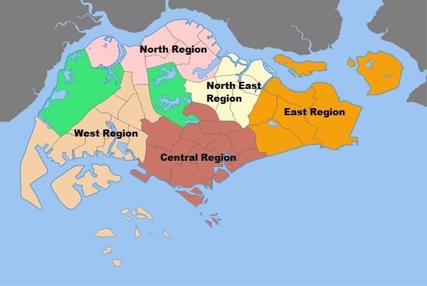
The Urban Authority of Singapore (URA) has categorized Singapore into 5 regions for urban planning purposes, namely Central Region, North Region, North-East Region, East Region and West Region. These 5 Regions are further divided up into smaller planning areas.
Central Region
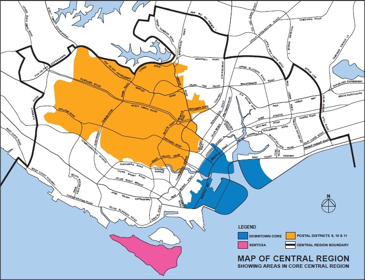
The Central Region can be divided into 2 sub-regions i.e. the Core Central Region (CCR) and the Rest of Central Region (RCR)
Core Central Region
The Core Central Region comprises of the following areas:
- Downtown Core (Marina Bay, Marina Centre, Raffles Place, Tanjong Pagar)
- Outram
- Sentosa
- Rochor
- Orchard
- Newton
- River Valley
- Bukit Timah
- Holland Road
- Tanglin
- Novena
- Thomson
Rest of Central Region
The Rest of Central Region comprises of the following areas:
- Bishan
- Bukit Merah
- Geylang
- Kallang
- Marine Parade
- Queenstown
- Southern Islands (except Sentosa)
- Toa Payoh
North Region
The North Region consists of the following areas:
- Central Water Catchment
- Lim Chu Kang
- Mandai
- Sembawang
- Simpang
- Sungei Kadut
- Woodlands
- Yishun
North East Region
The North-East Region consists of the following areas:
- Ang Mo Kio
- Hougang
- North-Eastern Islands
- Punggol
- Seletar
- Sengkang (Sengkang New Town, Rivervale, Compassvale, Buangkok, Anchorvale, Fernvale, Jalan Kayu)
- Serangoon
East Region
The East Region consists of the following areas:
- Bedok
- Changi
- Changi Bay
- Paya Lebar
- Pasir Ris
- Tampines


